Printed from the APC web site: navigation and non-essential images removed.
Please view on-line for full content (URL at end of document).
Visibility
What can we learn about the archaeology at Nosterfield without excavation? There are many techniques available to archaeologists that are known as 'non-invasive' methods of gaining information about below-ground archaeology.
Aerial photography can sometimes identify archaeological features in the landscape. Large and well-known feature types are readily identifiable but smaller, less well-defined or more complex features are much harder to identify, phase and date.

Part of photo
RU60 showing southern henge.
© Crown Copyright/MOD. Reproduced with the permission
of the Controller of Her Majesty's Stationary Office.
Original film held at Cambridge University Collection of Air Photographs.
Fieldwalking, literally walking over a ploughed field and plotting or collecting finds, is another technique that can identify areas of settlement or zones of activity. Sometimes factors such as land use or finds scatters that lie buried beneath the level of the plough limit the success of this technique (see archived news, 19th December 2003).
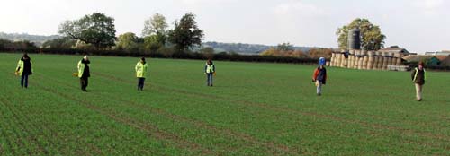
A team of archaeologists fieldwalking at Nosterfield
Consulting historic maps can identify the development of the use of landscape in more recent times, but for understanding prehistoric archaeology they are of limited use. They can sometimes help archaeologists to understand the more recent destruction of a prehistoric monument.
Surveys such as topographic and contour survey (a map of the shape of the land), geophysical survey and site visits can provide information on buried archaeology. Features contacted in geophysical survey can be as hard to understand as those in an aerial photograph (see geophysical report).


